Maps
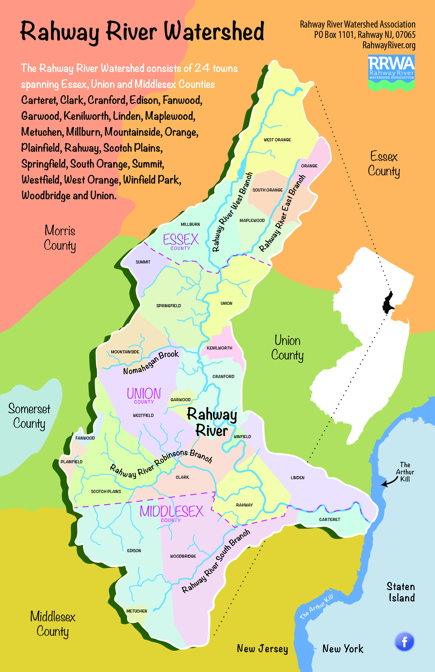 A new map of the Rahway River Watershed has been created depicting the 4 branches of the Rahway River, the West, East, South and Robinsons's branches, the Nomahegan Brook, a tributary, plus town, county and state borders. A new map of the Rahway River Watershed has been created depicting the 4 branches of the Rahway River, the West, East, South and Robinsons's branches, the Nomahegan Brook, a tributary, plus town, county and state borders.
You are free to use and share this map, however please credit the RRWA when doing so.
Click to view and download map
Rahway River Watershed Huc14 map
Rahway River Water quality monitoring locations
Rahway River Watershed elevation map
|